



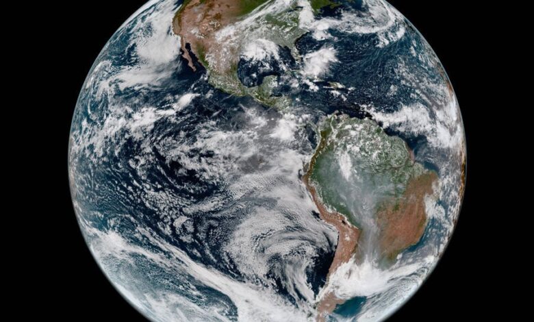
GOES-19 One Year Later: Protecting Communities Through Advanced Technology
In April, we mark the one-year anniversary of GOES-19’s operational role as GOES-East, a critical component of America’s cutting-edge weather satellite system. Developed by L3Harris Technologies, this satellite provides continuous monitoring of the Western Hemisphere.
L3Harris commemorates this milestone in partnership with the National Oceanic and Atmospheric Administration (NOAA). Since its launch, GOES-19 has been transmitting vast quantities of data daily, forming the foundation for over 50,000 detailed weather warnings issued by the National Weather Service.
“Every day, the instruments our team designed and built are helping forecasters communicate information that saves lives and protects communities,” said Shikha Ganguly, General Manager, Weather at L3Harris. “As catastrophic weather events become more frequent, we are incredibly proud to support NOAA and its essential mission.”
Precision Tracking When It Matters Most
During the 2025 Atlantic hurricane season, GOES-19 played a pivotal role, assisting the National Hurricane Center in tracking 13 named storms, including three Category 5 hurricanes: Erin, Humberto, and Melissa. Utilizing its Advanced Baseline Imager (ABI), the satellite employs rapid-scan capabilities alongside 16 spectral bands, providing forecasters with essential, high-resolution data.
The ABI, crafted by L3Harris, is the primary payload instrument for the entire GOES-R Series, delivering imagery that forecasters rely on during critical events.
Every hurricane forecast, tornado warning, or other significant alert that provides families time to seek shelter is supported by continuous data streams from GOES-19 and its equatorial counterpart, positioned 22,236 miles above the Earth. These satellites capture comprehensive imagery of the planet every 10 minutes, while severe storms can be monitored as frequently as every 30 seconds.
The implications of this capability are extensive. GOES data facilitates accurate forecasting that empowers emergency managers to orchestrate evacuations, allows airlines to adjust flight paths, and enables power companies to prepare essential infrastructure.
Building the Future of Weather Observation
GOES-19 is an integral part of a global network of satellites featuring seven L3Harris ABI-class instruments—four for NOAA, two for Japan, and one for South Korea. L3Harris is also innovating the imager for NOAA’s forthcoming Geostationary Extended Observations (GeoXO) satellite system, designed to enhance Earth observation capabilities currently offered by the GOES-R series. This system will introduce improved resolution for seven observation channels and incorporate two new channels for lower tropospheric water vapor measurement, expected to launch in the 2030s. Furthermore, L3Harris is providing advanced imager and sounder instruments for Japan’s next-generation Himawari-10 and for Korea’s GEO-KOMPSAT-5 mission.
Discover more about L3Harris’ Weather Satellite Technology
Source: L3Harris (2026-04-14)